Geographic Harbour

The area around Kodiak Island was proving to be one of the highlights of this part of the trip. We were quite happy to stay there another day. In the evening there were whales and the next day, more bears.

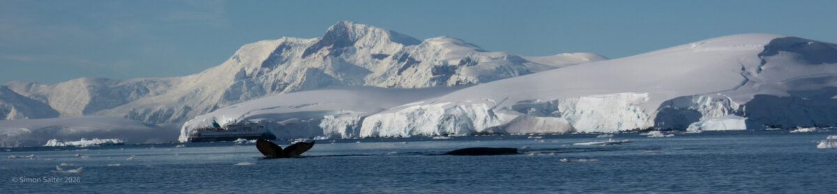
Photographing whales can be a bit tricky. You see a spout, grab the camera, point it in the correct general direction and then get to photograph the splash as the whale disappears under the water. Humpbacks can be a little bit easier. They surface briefly after blowing and then flip their tails up before diving. This is just about enough time to get the camera onto the whale. This is also why most of my whale photographs are the tails of Humpbacks. Fortunately, it is often possible to identify a whale from its tail. This is what a group called HappyWhale do. They use the patterns on the fluke of a whale to identify it and then maintain a database of where and when each animal has been spotted. People can submit their photographs and then every time one of your whales gets spotted you get a notification. Meanwhile, the database is fast becoming a valuable resource for studying whale behaviour.

The next morning was spent in Geographic Harbour on the south side of Kodiak Island. The weather stayed good and the bears were numerous. We floated about in the RHIB keeping a good distance from the bears. The bears took very little notice of us and were generally very occupied with the business of catching salmon. All too soon it was time to leave. The RHIBs were stowed and we set off along the Aleutian Island chain.

Kodiak

The next day was entirely dedicated to watching wildlife. We were in the area around Kodiak Island some 500 km south-west of Anchorage. The weather was perfect and the wildlife was prolific. Bears everywhere.

Katmai National Park, opposite Kodiak Island, was first designated a national monument in 1918 to protect the area around the Novarupta volcano. This was formed during the eruption of 1912. The biggest eruption of the 20th century it created the Valley of Ten Thousand Smokes, a 100 km2 pyroclastic flow up to 200 m deep. The park hosts 18 volcanoes of which 7 have been active since 1900 including the centre-piece Katmai stratovolcano. Since the initial establishment of the park, it has become increasingly well known for its abundance of wildlife. This includes many brown bears that feed off the sockeye salmon.

Our first trip out in the morning was mostly about watching a single brown bear. This was at Kukak Bay in the Katmai National Park. He was catching salmon in one of the many small rivers emptying into the bay. Watching from the RHIBs seemed ideal. The animals took truly little notice of us so we could easily get quite close.

In the afternoon we went round to the other side of Kodiak Island. The island is big. Second largest in the United States and bigger than Cyprus. Two thirds of the island is designated as the Kodiak National Wildlife Refuge – home to the Kodiak bear and all five types of Pacific Ocean Salmon. We saw more bears there. Also, a Sitka deer, enormous star fish, a fox, loads of seals and a Bald Eagle with two youngsters.

Icy Bay

Going further north we arrived at Icy Bay. The ship nosed its way into Tsaa Fjord and they launched the RHIBs. The Amundsen cannot sensibly drop anchor here because the water is too deep. Instead, they use a clever Dynamic Positioning (DP) system. Multiple GPS receivers are used to accurately determine the position and orientation of the vessel. The DP uses the ship propellers and bow thrusters to keep it in exactly the same place. In effect, they can just park the ship anywhere. We spent the afternoon pottering around in the RHIBs. A group of canoeists went out. There were no shore landings. I don’t think that is allowed here by the park rules.

Several glacier tongues drop down into Icy Bay making for a spectacular scene of ice and cliffs. The amount of meltwater was phenomenal. I have never seen anything like it. It is normal, in the summer, for meltwater to permeate through the glaciers and run out at the bottom. In Svalbard, we explored an ice cave that was made in just this way. Here, there were thundering great torrents of water coming out from under the ice. It was impressive and noisy. Huge waterfalls were gushing out. The water was heavily sediment laden making it a dirty grey colour.

The next day we continued making our way north along the Alaskan panhandle. Wonderful little islands and small settlements. We passed many more glaciers and at one point, paused to watch a distant bear on the shore.

Wrangell

Wrangell (pop ~2,000) was founded by the Russians in 1834 when they built a fort. This makes it one of the oldest non-native settlements in Alaska. The British Hudson Bay Company leased the fort and eventually Wrangell became American when the United States bought Alaska from Russia in 1867. Today the main industries are fishing, logging and tourism. Wrangell is close to the River Stikine delta. The Stikine is a major river flowing from British Columbia. Historically, it has always been important for fishing, hunting and trade. Now it is also important for tourism and as a recreational area.

We joined a group in a jet boat to explore part of the river. The boat was very fast and also very noisy. Talking was near enough impossible. So, the day was made up of short, relatively peaceful intervals in between high-speed dashes along the river. We travelled through the delta and then a short way up the main river. A left turn took us onto Shakes Slough, a tributary. We followed this all the way up to a Shakes Lake which ended at a glacier.

There was some wildlife on the route. Mostly birds. We got quite close to a pair of Bald Eagles. One was guarding a nest while the other was eating by the river. We also came across a government boat measuring fish. Fishing is tightly controlled after several incidents of overfishing nearly wiped out the salmon completely.

In the lower reaches of the river, we came across several houses that were floating. Not house boats but normal looking wooden houses built on floating pontoons. For some reason, the river and the surrounding land are managed by different authorities. Locals are not allowed to build weekend accommodation on land but they can have a semi-permanent structure if it is floating.

Arriving at the lake, we drifted right up close the glacier and enjoyed some wine and snacks. A cool breeze coming off the ice made it at least ten degrees colder than back down at the delta. Twenty minutes later we began the trip back down. This seemed faster than ever. This time we were not stopping for sightseeing. My ears were ringing by the time we got back to the dock.