Guess what time we got up in the morning? Unfortunately, despite the ridiculously early start, we did not see so much on this particular morning. The one exception was a small flock of night hawks. Half a dozen of these pretty birds were sitting on a branch. Until we arrived, then they flew off.


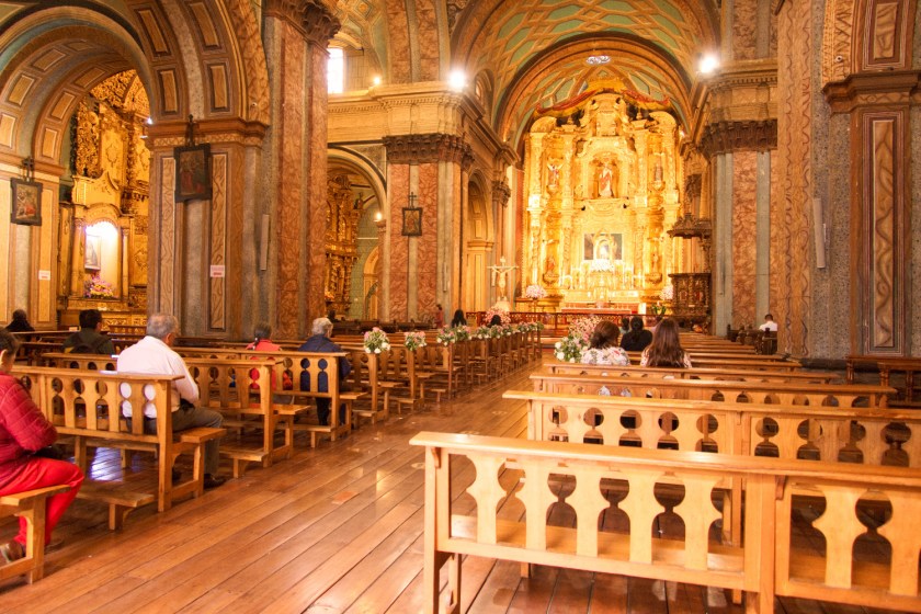
Back on the ship I wandered round taking a few pictures of the interior. The air-conditioned cabin was our haven. Spacious and cool with a terrific picture window. After each excursion we would arrive back at the room hot and sweaty. After a shower and, occasionally, a nap, we would be cool and clean and ready for the next episode. The ship was built locally and, for the most part, used local materials. The whole of the inside of the boat is done in some lovely wood. Not sure quite what type of timber but presumably a tropical hardwood. Looked terrific and gave the décor a great feel. The bar was on the open top deck. From here we could watch the river roll past while sipping Pisco Sour cocktails. On the same deck was a lecture room where we had talks about the Amazon and the occasional film. On the deck below was the restaurant. Food was very good on this trip and we felt the chef had really tried hard to provide for vegetarians.


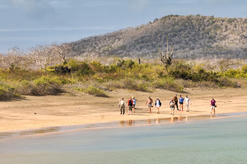
In the afternoon we visited a village. Here they demonstrated making straw goods. We were shown how they prepared the fibres and coloured them with various natural dyes. We also had a bit of a cooking demonstration. Mostly they eat fish from the river. Different sorts of fish are cooked in different ways all of which smell awful to me. Deep fried yuca with a yellow tomato sauce was very nice though. Yellow tomato is not, as it sounds, a tomato that happens to be yellow. It is a whole separate species that looks a little like a yellow version of the familiar red fruit but tastes very different. Sharp, intense and flavoursome. Just chop finely into a bowl to make and instant tasty dip. Later, the ship moved closer to Iquitos. Here we spent the night ready for a quick getaway in the morning.


Next morning there was time for breakfast before we disembarked and headed for the airport. On the way we visited an animal sanctuary. There were some interesting beasts here that we had not seen in the wild. First up were the Paiche. Gigantic fish, up to 3 m long, that swim around in the Amazon. These were almost certainly around in many of the places we visited but were lurking, hidden in the murky waters. Here they were in an enormous, glass walled tank where we could see them very clearly. Paiche are vulnerable to overfishing and a 2014 study found that the fish were depleted or overexploited at 93% of the sites examined. Despite these issues, Paiche had still been served several times on our ship.
The sanctuary served as a general home for unwanted or rescued creatures. There were many sorts of parrot, a sloth, turtles and caimans. I had to look this up, but the plural of caiman is caimans and not caimen. This seems a shame. Several big tanks held young manatees. These lovely “sea cows” are peaceful herbivores that graze the river vegetation. They are another endangered species and again their primary threats are from humans. Often, they are hunted and a large number of manatees get injured or killed from boat strikes. Habitat loss is another problem.


Sanctuary done we went to see a stingless bee project. Bees without stings seem like a good idea to me. They can also be used to provide essential vitamins and minerals for local children.
Amazon done. From Iquitos we back to Lima for the sixth and final time. Night in the airport hotel. Not especially great but eminently practical. Next morning we flew to Bogota. This was not because we especially wanted to visit Bogota but more to split up the trip back. I worked out that Bogota to Madrid was about the shortest cross Atlantic flight. Bogota turned out to be a perfectly nice city with an awful lot of graffiti. The weather was warm and the people friendly. We wandered around on a couple of days and took a cable car to where we could overlook the whole city. All eight million people. Bogota is one of the world’s largest cities. Remarkable to see so many people in one place.
Next stop was Madrid. A lovely city that I visited 30 years ago. We only had a couple of days here but it was nice to explore the old city and experience a little of the night life.
Then we flew to Paris. This is city is quite familiar to us. Bit manic but great fun. We checked out the restoration work at Notre-Dame on the way to a candlelit piano recital at St. Ephrem Church. Next afternoon we had booked a guided wine tasting. Sadly, this did not work out so we simply went out and tasted a few wines by ourselves.


Final leg back to the UK was the Eurostar train to London St. Pancras. This was quite a pleasant way to travel and a lot less hassle than flying. Quite expensive though. In London we only just made our connection to intercity train north. Back in the day they would have served wine and snacks but this time a cup of coffee was as far as it went. We detrained at Mirfield for the very last train leg back to Todmorden. The platform signage was all messed up and we ended up waiting over an hour for our connection on the small, deserted platform. It was dark and cold. Rain was in the air. Welcome back to the UK.